Lower Hutt Forest and Bird has achieved many projects that have “Given Nature a Voice”.
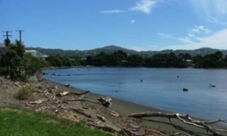
2011 Korokoro Stream
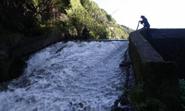
Mussel spat ropes have been installed over the lower dam in Korokoro Stream. Many of our native fish species can climb over stream obstructions. They climb the wet ropes by holding on and working their way up the ropes and resting where water pools in the complex rope structure.
The installation was a joint project between Lower Hutt Forest & Bird, Korokoro Environmental Group (KEG) and Greater Wellington. There will be ongoing monitoring of the ropes' effectiveness when the fish return from the sea: many NZ native fish are diadromous, that is, they spend their juvenile stage in the sea and return to native rivers and streams to live as adults. Obstructions such as the dam prevent fish using the upper reaches of streams and rivers.
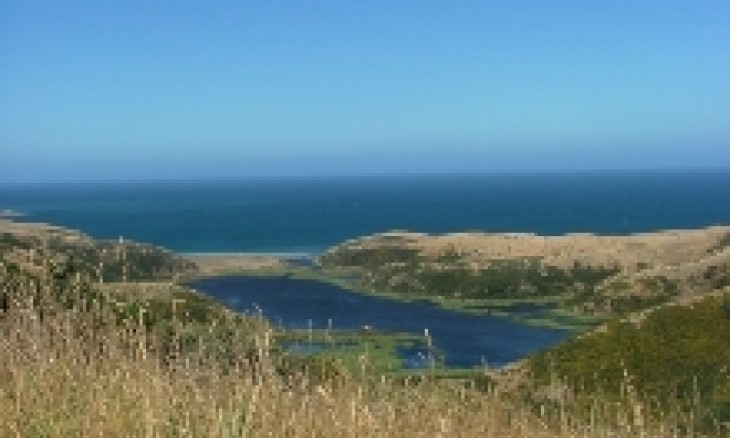
2010 Baring Head
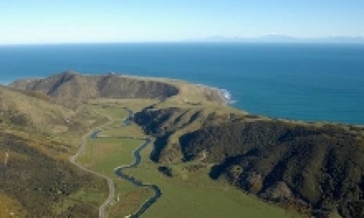
In 2010, Lower Hutt branch contributed to the effort to convince some of the local politicians to find $M1.77 to buy Baring Head. There was no time to write letters. This campaign consisted of appearing and speaking at Council meetings to show that conservationists were behind the purchase, pleas for F&B members to write to their local politicians in support and to put the matter on the agenda so we could speak in support of it. It was the public, pro local politicians, DoC and the Nature Conservancy who achieved this.
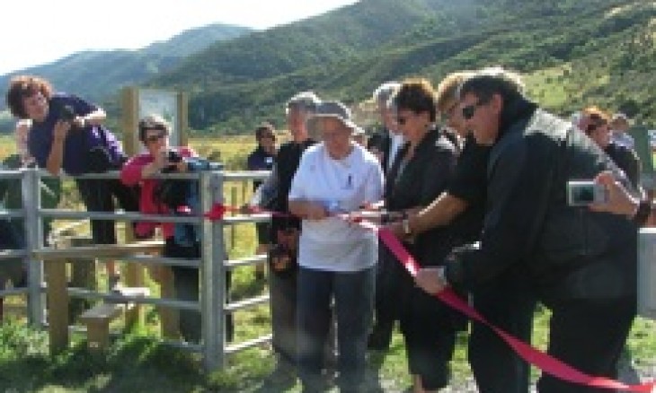
Public opening of Baring Head, 13 February 2011
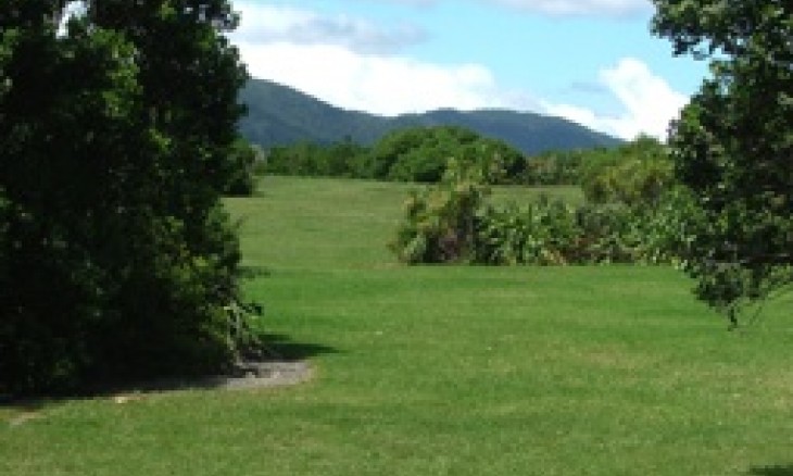
This Headland is on the eastern side of the outer Wellington Harbour. It has wild coast and coastal wetlands. It has geological features such as raised beaches and far older raised beaches where the sea level has subsequently dropped leaving them preserved 60 meters above the current sea level. They are uplifted marine terraces of national significance. The rock strewn, coastal cliffs below cloaked in flaxes and cabbage trees are ideal breeding places for penguins while the lower beaches have black backed gull and Caspian tern colonies. Variable oystercatchers and banded dotterel are also present. The Baring Head block contains the lower reaches of the Wainuiomata River and its river terraces with wetlands in old river channels. Rising from the river terraces are steep scree slopes with rare grey scrubland communities and a rare invertebrate. Maori cicada and katipo spider are also present. There is little doubt that Maori used this area in earlier times. Europeans have farmed the area and, importantly for shipping, the head was used for a manned lighthouse facility. NIWA currently use the site for atmospheric testing. There is not much to the south apart from the South Pole.
1991 Parangaraha (Pencarrow) Lakes
Pencarrow Lakes
The Parangarahu Lakes are now considered to be some of the best freshwater lakes in NZ. This is because they have very few introduced weeds (no oxygen weeds) and only one introduced fish (brown trout) in Lake Kohangatera. They contain both bittern and spotless crake. The altitude is also key because these lakes are slightly above sea level. It is very unusual to find pristine lakes at low altitudes. In 1991, these lakes and surrounding farmland came on the market. Forest and Bird proposed that the Wellington Regional Council purchase the area and gave $5000 to start the fund to save them. This resulted in the purchase. They are now part of the East Harbour Regional Park and the surrounding land is being revegetated.
1984 Pauatahanui Wetland
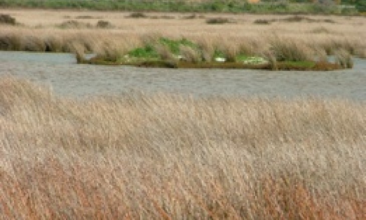
Pauatahanui Wetland
In 1984, Lower Hutt branch took leadership of the restoration of Pauatahanui. Paths were planned and built. Hides were constructed off site, transported to foundations and erected. Areas were weeded, sprayed or scraped clean, and seed was sourced and grown in nurseries and the plants then planted into the reserve. A visitor centre was put on the site. Areas were re-flooded. Roosting areas were constructed. The whole of the wetland area was turned from what would have been a wasteland and probably “reclaimed” into a vibrant and fresh and salt wetland loved and visited by many people. This project was slightly outside of our area and is now managed by Kapiti/Mana branch. But we are proud of the part we played in giving a voice to this tidal part of nature.
1984(?) Upper Stokes Valley
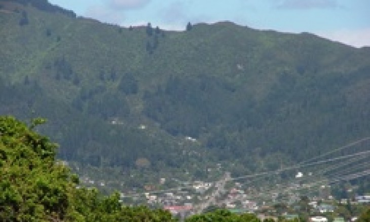
Upper Stokes Valley
In about 1984, development was proposed continuing three roads up the steep hillsides at the head of the valley to develop a huge subdivision up to the ridge line. The developer needed a scheme change before they could proceed. This would have resulted in the loss of much of the mature and regenerating forest, the loss of walking tracks, greater risk of flooding in Stokes Valley and more stormwater in the Hutt River. LHF&B opposed the scheme change. The end result was the sale of 5 sections at the current ends of each road and the reservation of the rest of the land that extended right up to the ridgeline. That land is now an important part of the proposed ecological corridor between East Harbour Regional Park and Belmont Regional Park.
1981 Matiu/Somes Island
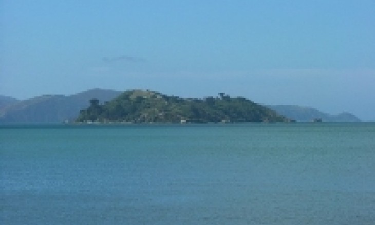
Somes Island
In 1981 the Mayor of Wellington decided that Somes Island would be great with a casino on it. Forest and Bird proposed an alternative future for Somes: revegetation, days when people could visit, removing the only introduced predator (rats), and reintroducing fauna that used to live on Matiu/Somes. Thirty years later, that future has been more than realised. Matiu/Somes is a scientific reserve, is largely revegetated, valued and managed by DoC, visited daily and has accommodation for those who wish to stay overnight. Matiu/Somes now has populations of red fronted parakeets, robins, tuataras, and four species of lizard, receives many tourists and locals daily, has 3 high occupancy accommodation buildings and a camping facility. Read more about the restoration of Matiu Somes Island by purchasing Lower Hutt branch’s book,A New Cloak for Matiu.
1980 Hikoikoi Reserve
Hikoikoi Mudflats
This reserve is on the western bank of the Hutt River at its mouth. When development plans were floated for the reserve one proposal was to make the centre an “industrial park” and surround it with landscaped and manicured lawns down to the river’s edge and seashore. The planners proposed an area of pine trees on the higher land forming a central focus. LHF&B opposed the plan and asked for native planting with open space for people to walk and picnic and a natural transition to the land, river and sea. We also asked for protection of the Waione Street mud flats, the only mud flats left in the Wellington Harbour. We appeared on television news when concrete piles were dumped on the side of the mudflats. This resulted in the positioning of very large concrete blocks that would in future stop any trucks getting near enough to the mudflat to dump waste.
Hikoikoi Public Areas
They are still visible today under trees planted by LHF&B. Dumping of concrete by the local concrete company on the edges of the land was a continuing problem. They used the area to dispose of unused unset concrete. We took an interest in everything that went on in the park and we suggested a change of name
from East Harbour Foreshore Reserve to Hikoikoi Reserve. The name Hikoikoi is the name of a local early pa site. Our interest and activity resulted in a park from Waione Street Bridge to the Petone foreshore that protected the environmentally important areas, resulting in areas of native plants, a walk and grassed areas for the public to enjoy.
1977 Korokoro
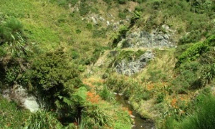
Korokoro
A large dam was proposed slightly downstream of the Korokoro forks to
prevent flooding at of the Hutt Road and eastern Petone foreshore. The dam
would have a culvert cut in its lower section and, most of the time, would have simply allowed the stream to pass through. However when the stream flooded the culvert would reach capacity and the water would build up behind the dam flooding the landscape. When the rainfall event passed, the dam would empty through the culvert. This type of dam leaves huge mud filled areas upstream where the floodwaters accumulate and dead trees because the trees could not survive regular inundation.
We publicised our opposition to the building of this dam, cut a track up the valley and took trips up it showing people where the dam would be situated and explaining how it worked and the effects it would have on the landscape. The plan was finally dropped.